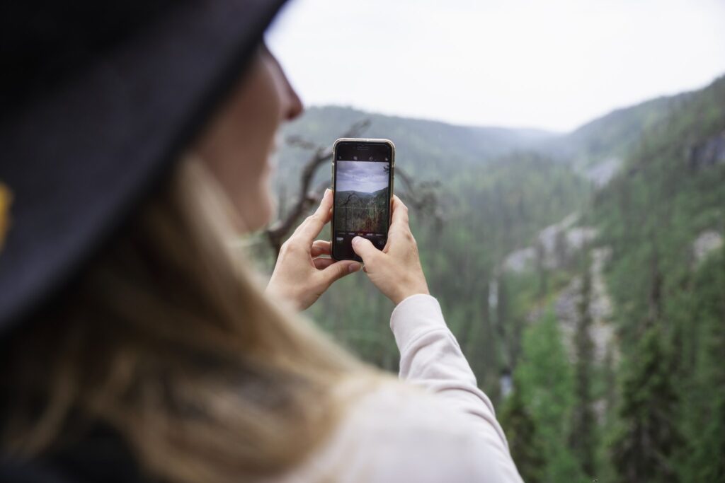
The sloping bogs and the snow-covered trees of Riisitunturi National Park are known among nature photographers worldwide.
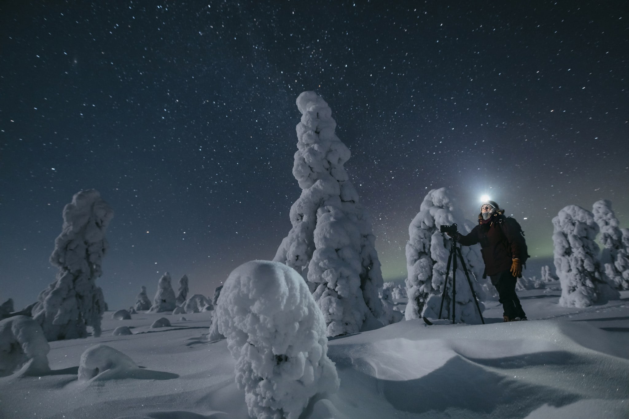
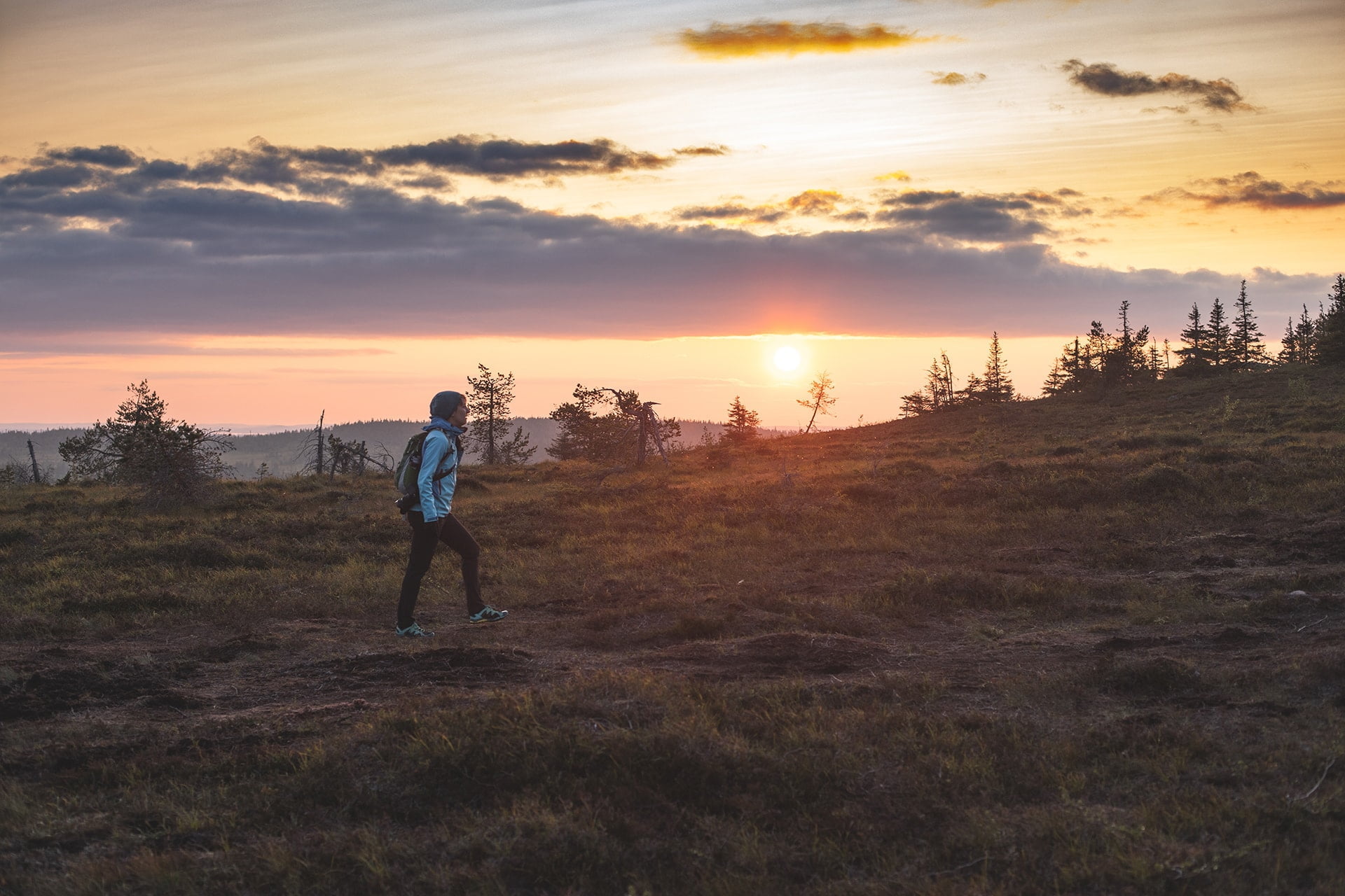
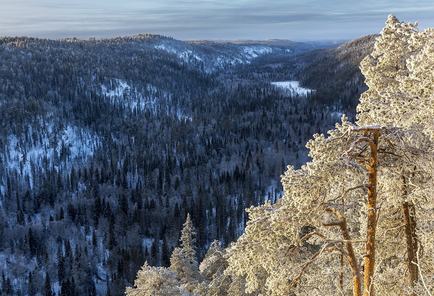
Riisitunturi National Park provides a delightful playground for nature lovers. The hillsides of the park are decorated by rare slope mires and the bare fell tops offer breathtaking views over Lake Kitkajärvi and the forests beyond. In the winter the candle-like spruces are clad with a thick coating of condensed frost, creating a photogenic white forest. The highest peaks of Riisitunturi rise above 400 meters.
ACCOMMODATION NEAR THIS PLACE
Stay overnight close to national park. Read more here
RIISITUNTURI NATIONAL PARK HIKING ROUTES
Riisitunturi National Park is a breathtaking hiking destination all year round. The two circle trails of 4 and 11 km are ideal for day hikes, whereas the 30-km out-and-back trail is perfect for those who enjoy a more challenging experience
Duration: 2-3 hours
Trail markings: Green paint
Difficulty level: Medium, circle trail
Suitability: The trail travels mostly on graveled road with some duckboards on the way. Elevation is 110 m. Suitable for the whole family. A good destination for snowshoers, hikers, bird watchers and photographers.
Trail description
The starting point of Riisin rääpäsy is on the very border of the national park. The circle route runs clockwise towards the Great Riisitunturi peak (465 meters above sea level) in a varying forested hill and fell scenery. The summit has a resting place, which offers spectacular views over Lake Kitkajärvi and far into the forest wilderness of Posio.
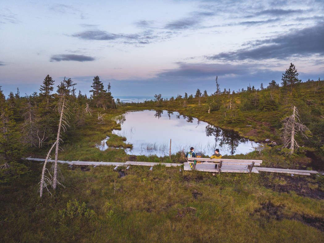
After the peak, the route starts to descend back towards the starting point. The way back down is decorated with hanging bogs, which are crossed along duckboards. One of the most memorable sights on the way is Pond Ikkunalampi, which seamlessly blends into the surrounding landscape. Afterwards it is a pleasure to stop and have a bite to eat at the Riisitunturi open wilderness hut.
Good to know
About half-way down the trail there is an open wilderness hut (6 beds) with a campfire site and dry toilets. In addition, there are smaller resting areas on the way (at the top of the hill and next to the Ikkunalampi pond) with seats.
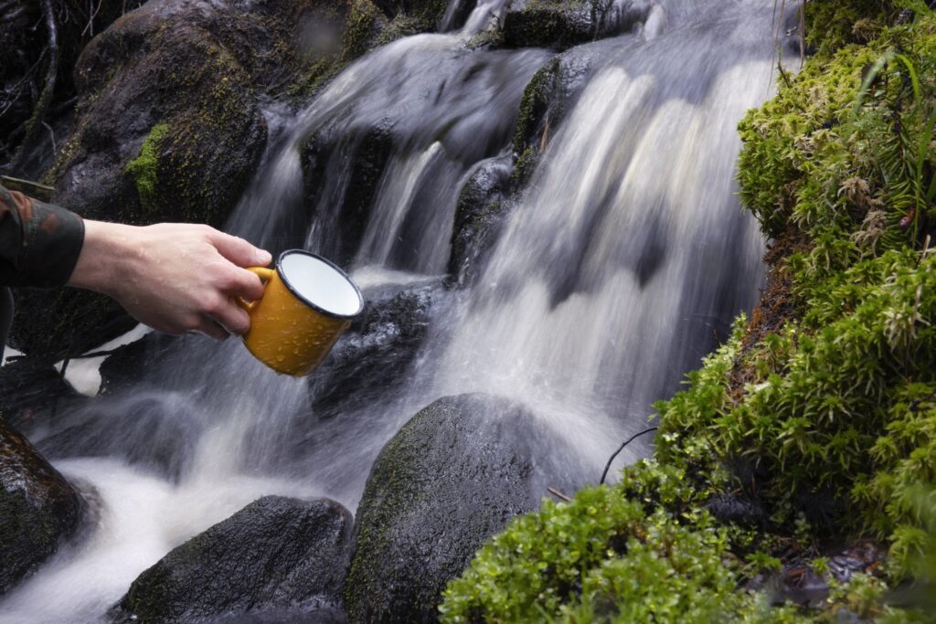
You can enjoy a steaming hot cup of coffee or tea before or after your hike in Korpihilla café and delicacy shop (check opening hours at +358 400 901 910) located in the village of Tolva.
To start the trail
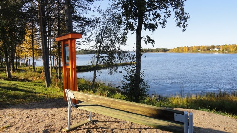
The starting point of the trail is about 35 km from the center of Posio. Drive 15 km from Posio into the direction of Kuusamo. Turn left to road Patoniementie and drive about 16 km until you see a signpost pointing to the left, to Riisitunturi National Park. Turn left and continue about 3 km until you reach the border of the National Park. There is a parking area and an information shelter in the starting point, where you will find information about the area and its history.
You can reach the point with a car or taxi (Tel: +358 16 3721 555).
Starting point
WGS84
lat: 66° 12.9364′
lon: 28° 35.2439′
ETRS-TM35FIN
P: 7344847m
I: 571431m
KKJ
P: 7347919m
I: 3571632m
Duration: 4-5 hours
Trail markings: Green paint
Difficulty level: Medium, circle trail
Suitability: Suitable for the whole family. A good destination for hikers, bird watchers and photographers. It is recommended to wear waterproof shoes as the trail is partly wet. Route entails many duckboards. Elevation is 160 m.
Trail description
The starting point of Riisin rietas is on the very border of the national park. The circle route runs clockwise towards the Great Riisitunturi peak (465 meters above sea level) in a varying forested hill and fell scenery. The peak has a resting place, which offers spectacular views over Lake Kitkajärvi.
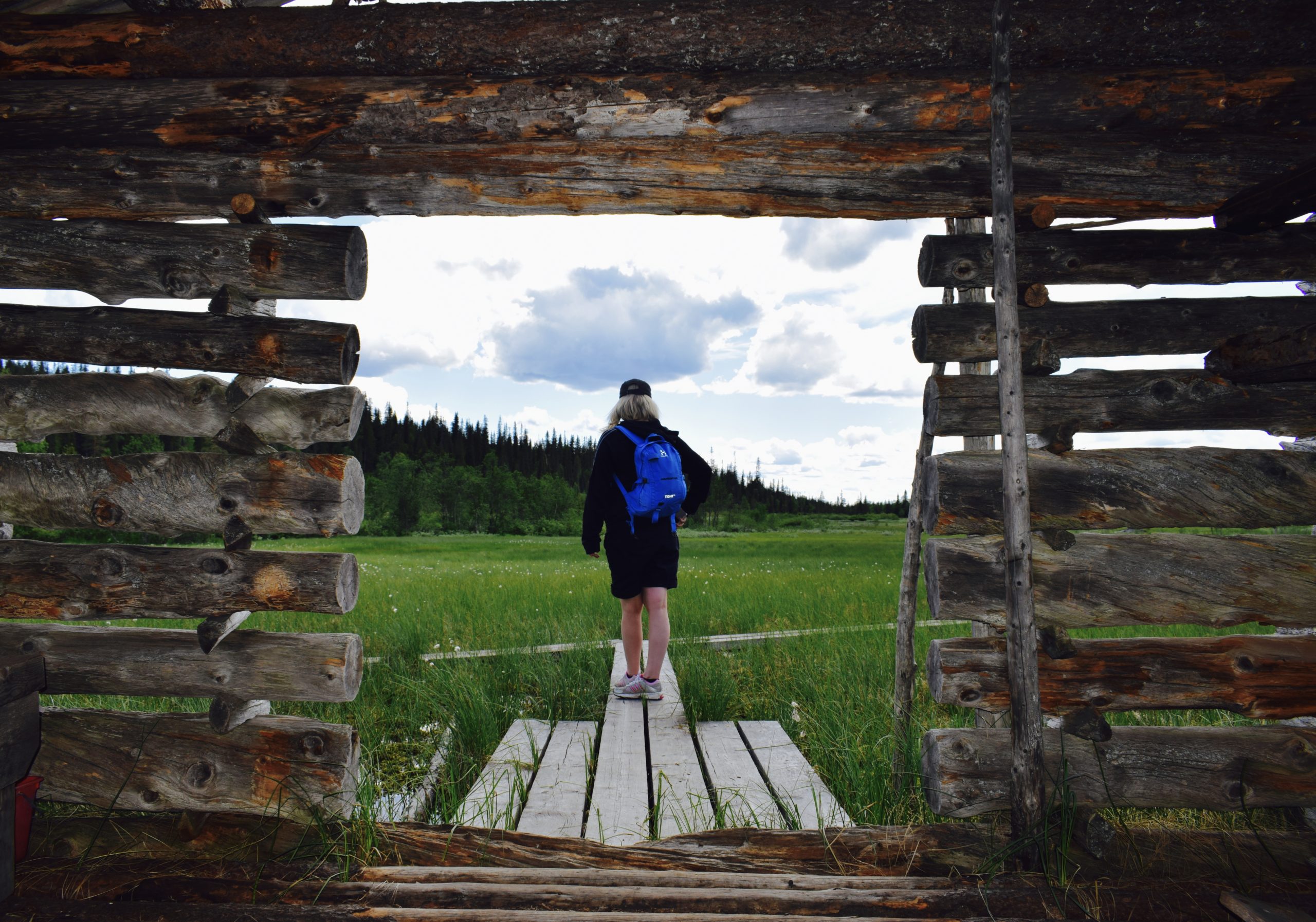
After the peak, the route differentiates from Riisin rääpäsy trail and turns left into the wilderness. The trail climbs the fell slopes passing Pond Uusilampi, Nuolivaara highlands, Riisinsuo bog region and Small Riisitunturi fell. The highland areas offer spectacular views of the most expansive sceneries of Posio over Lake Kitkajärvi and forests beyond. Hikers are also enchanted by rare hanging bogs, River Riisijoki and other small creeks and streams as well as the impressive Riisinsuo meadow area, where you can visit the Riisinsuo barn and get an insight into the secrets of the meadow culture that thrived in the past.
Good to know
Along the way there are two lean-to shelters with campfire sites, an open wilderness hut (6 beds) and other smaller resting areas. You can enjoy a steaming hot cup of coffee or tea before or after your hike in Korpihilla café and delicacy shop (check opening hours at +358 400 901 910) located in the village of Tolva.
The trail got its name from a ghost that was reported to have haunted hikers in the late nineteenth and early twentieth centuries. It was believed that a man had once been killed in the area, but his body was never found. Along the trail there are a number of information points telling about how people lived back in the days: collecting herbs from the nature, harvesting hay from natural meadows for the cattle and felling forest.
To start the trail
The starting point of the trail is about 35 km from the center of Posio. Drive 15 km from Posio into the direction of Kuusamo. Turn left to road Patoniementie and drive about 16 km until you see a signpost pointing to the left, to Riisitunturi National Park. Turn left and continue about 3 km until you reach the border of the National Park. There is a parking area and an information shelter in the starting point, where you will find information about the area and its history.
You can reach the point with a car or taxi (Tel. +358 16 3721555).
Starting point
WGS84
lat: 66° 12.9364′
lon: 28° 35.2439′
ETRS-TM35FIN
P: 7344847m
I: 571431m
KKJ
P: 7347919m
I: 3571632m
Duration: 2 days
Trail markings: Orange paint
Difficulty level: Medium, out-and-back trail
Suitability: Suitable for experienced hikers. Due to the length of the trail, we recommend reserving plenty of time, food and water for the trip. It is also advisable to take a map or/and gps. A good destination for cross-country skiers, snowshoers, trekkers, bird watchers and photographers.
Trail description
Riisitunturi Trail goes over the fell tops from Noukavaara in the north-east via Riisitunturi Fell to Karitunturi Fell in the south-west, where there is a connection trail to Kirintövaara. The route travels in varying forest, fell and mire sceneries. The highland areas offer spectacular views of the most expansive sceneries of Posio over Lake Kitkajärvi and forests beyond. Hikers are also enchanted by rare hanging bogs, small creeks and streams as well as the impressive Riisinsuo meadow area, where you can visit the old barn and can get an insight into the secrets of the meadow culture that thrived in the past.
Good to know
Along the way there are four lean-to shelters with campfire sites, the Riisitunturi open wilderness hut (6 beds), Karitunturi Day Trip Hut and other smaller resting areas with dry toilets.
Kirintövaara recreation area has several rental cottages as well as Hotel Kirikeskus, which is located at the foot of the Kirintövaara fell. In the winter, the area is a skiing center with 60 km of cross-country skiing tracks, three ski slopes as well as snowmobile route connections to Ruka, Suomu, Syöte and elsewhere in Lapland. During the summer, activities include orienteering, disc golf, geocache orienteering and hiking.
A longer hiking trail, the National UKK Trail, goes through the National Park following Riisitunturi Trail through Kirintövaara, Karitunturi, Riisitunturi and Noukavaara. From Noukavaara onwards the markings of the trail are insufficient and therefore the route is suitable only for hikers with good navigation skills. This trail goes all the way to Rukatunturi and Oulanka National Park.
To start the trail
There are two starting points for the trail – in Noukavaara and Kirintövaara. The trail can be started from whichever end.
The Noukavaara starting point of the trail is about 40 km from the center of Posio. Drive 15 km from Posio into the direction of Kuusamo. Turn left to road Patoniementie and drive about 20 km to the village of Tolva. Take a left to road Holtinojantie and drive 8 km to the starting point. This road is in bad condition, and it is not maintained during the winter.
The Kirintövaara starting point is about 9 km from the center of Posio. Drive 6 km from Posio in the direction of Kuusamo and turn left to Kirintövaara when you see a sign for Hotel Kirikeskus. The starting point is the parking area of Hotel Kirikeskus, where you will also find information boards.
The points can be reached with a car or taxi (Tel. +358 16 3721555). You can also take a bus to the Kirintövaara junction (on the road Kuusamontie), from where there is a 2.5 km walk up the fell to reach the Kirintövaara starting point. Buses leave twice a day and start from Ingan Tupa café (Address: Toritie 4). Detailed schedules: www.matkahuolto.fi. From the end point you will need to hike or take a car/taxi back to the starting point. Hotel Kirikeskus also offers transportation service.
Noukavaara starting point
Address: Holtinojantie, 97925 Posio
WGS84
lat: 66° 15.3223′
lon: 28° 36.4014′
ETRS-TM35FIN
P: 7349301m
I: 572185m
KKJ
P: 7352375m
I: 3572386m
Kirintövaara starting point
Address: Kiririnteentie 1, 97900 Posio
WGS84
lat: 66° 6.4674′
lon: 28° 17.0842′
ETRS-TM35FIN
P: 7332519m
I: 558060m
KKJ
P: 7335586m
I: 3558255m
The winter trail for snowshoe, backcountry skis and fatbikes runs from the parking area to the Riisitunturi Open Wilderness Hut and further onwards to the Soilu lean-to shelter. The distance from the parking area to the open wilderness hut is 2 kilometres and to the Soilu lean-to shelter 4 kilometres.
From the Soilu lean-to shelter, the trail continues on a steep decline towards Rinnesuo Mire then south via Riisisuo Mire to the Uusilampi lean-to shelter. This section of the track is a circular route. The distance from the parking area to the Uusilampi lean-to shelter is 8 kilometres.
From the Uusilampi lean-to shelter, the track runs north-west towards Lake Kolmiloukkonen, from where it continues around Nuolivaara Hill towards Soilunsuo Mire. From Soilunsuo, the track continues towards Rinnesuo Mire and then runs back along the same route via the Soilu lean-to shelter and the open wilderness hut to the parking area.
Track is maintained twise a week on Tuesdays and Fridays. Yuoa can check latest grooming from www.infogis.fi/posio/
For more information on the track maintenance situation in winter, please contact Lauri Sassali at Kota-Husky, tel. +358 40 718 7287
Please Note
The same track is also used for dog sledge tours, and other users must always give way to the sledges.
Please keep in mind that the track is only available in the winter and biking is not allowed in the national park when there is no snow on the ground.
Additional information
Location
Cafes and restaurants:
There are atmospheric cafés and a restaurant near Riisitunturi.
- Riisitunturin Tupa cafe next to parking place
- Korpihilla
- KitkanRiisi
- Himmerki
Services
Wilderness and nature guides
Husky safaris
Snowshoe rental
- KitkanRiisi 25€/day ( 6km from Riisitunturi)
- Adventure Apes
- Holiday Village Himmerki 10 €/day
- Lapin Satu 10 €/day
Cross-country ski rental
- Holiday Village Himmerki 15 €/day (incl. skis, poles and boots)
You also might be interested in

Nature
Kirintövaara
Nature
Korouoma
Nature
Livojärvi
Nature
Accessible Trails
Sustainability
Green Key